WEATHER WEB SERVICE: DATA INTEGRATION
Today, one of the most widely used ways of exchanging information and functions between different software applications is the web service. This method of displaying data is particularly versatile when the object of the exchange is meteorological-climatic data since the organisation of such data into spatially- and temporally-ordered datasets makes them easier to transmit with this technology.
METEO WEB SERVICE QUERY METHODS
Given the particular space time organization of meteorological-climatic data, the querying methods used can be substantially broken down into four categories:
- request for the entire three-dimensional grid (time, latitude, longitude) or a subset thereof,
- request for the two-dimensional grid (latitude, longitude) set at a particular instant in time,
- request for vector data (e.g. station and lightning data),
- request for time datasets for a particular geographical location.
The first three types of queries are made possible through OGC (Open Geospatial Consortium) protocols implemented by the GeoServer that manages the entire Hypermeteo data infrastructure.
The following OGC services are available:
WMS
WMS, which provides a catalogue of layers with which to create maps, which can then be provided in raster formats (PNG, GIF, JPEG images) for which style and geographical projection can be customised
WFS
WFS, the protocol used to access and edit geographical features in vector format (e.g. station and lightning data); it provides the results in GeoJSON format,
WCS
WCS, with which the datasets (or subsets thereof) can be exported in raw format (netCDF).
The exposure of the weather data through OGC protocols, allows their instant integration in GIS platforms both of the opensource type (eg QGIS) and of the proprietary type (eg ArcGIS by Esri).
OUR WEATHER WEB SERVICE API
Presenting the data through OGC protocols means they can be instantly integrated into both opensource (e.g. QGIS) and proprietary (e.g. Esri’s ArcGIS) GIS platforms.
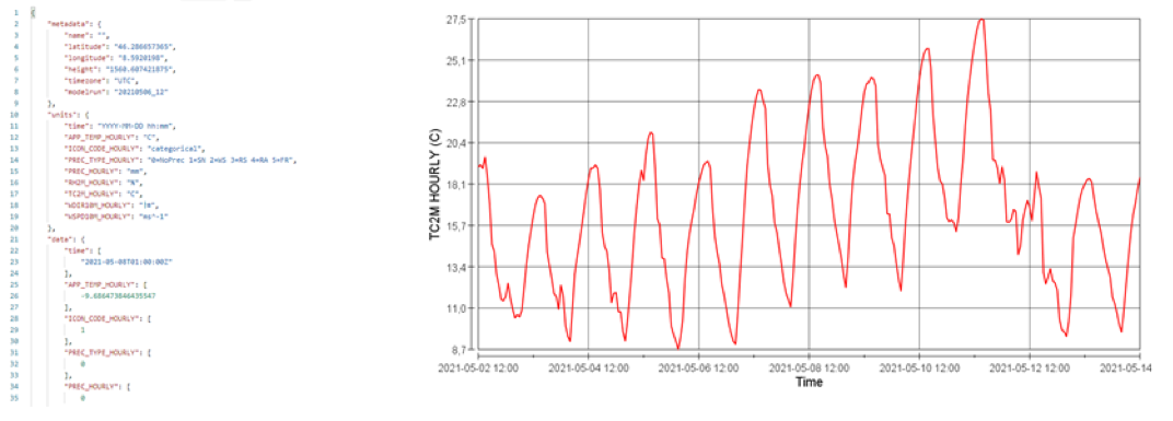
Time series for specific locations are requested via a CUSTOM WEATHER API service implemented by Hypermeteo. This makes it possible to obtain the trend in time of different meteorological variables given a specific geographical location, a set of variables, the type of data (e.g. near real-time, forecast etc.) and the desired time window. The output format can be in JSON — for on-the-fly integration of the data into applications — or CSV.
WEATHER DATA TRANSMISSION MODES, FORMATS AND PROTOCOLS
Hypermeteo is a service that provides and processes meteorological data for systems that then integrate them into third-party processes and procedures. To do so, it must guarantee a wide range of formats and ways of displaying data in order to interface with multiple users that follow standards and procedures that are sometimes very different from one another.
Table 9 shows the transmission modes, formats and protocols used for the main data deliverables.
| Historical weather data | Near-real-time data | Meteo Nowcasting and forecasting data | |
|---|---|---|---|
| Methods of delivery | One-off | Continuous updating | Continuous updating |
| Update frequency | - | Hourly, daily | Up to 5 minutes |
|
|
JSON, CSV, BUFR, NETCDF, GEOTIFF, ASCII GRID | JSON, CSV, BUFR, NETCDF, GEOTIFF, ASCII GRID | JSON, CSV, BUFR, NETCDF, GEOTIFF, ASCII GRID |
| Transmission protocols | FTP/SFTP/bucket AWS s3API-Webservice (OGC e custom) | FTP/SFTP/bucket AWS s3API-Webservice (OGC e custom) | FTP/SFTP/bucket AWS s3API-Webservice (OGC e custom) |
Hypermeteo’s customers


Some of our customers


Previous
Next
