The risk of exposure to droughts has increased in recent years, extending even to areas where they were not previously experienced, such as the Alpine region. The sector most directly affected by drought is agriculture, since the entire production chain is affected, but the hydro-electric power sector is also affected, both in terms of production and planning.
The Snow Water Equivalent (SWE), i.e., the amount of water available as the snowpack melts, is a key variable in assessing the available water supply in mountain basins.
Radarmeteo and Hypermeteo have developed a new system to provide high resolution and accurate SWE data. They are obtained through algorithms fed from all available observational sources (on-site measurements from snow gauges, satellite measurements and those from meteorological reanalysis datasets), spatialised using different statistical procedures and integrated into a cryohydrological model.
This makes it possible to provide a constantly updated dataset relating to this variable, in order to monitor and improve basin management.
CASE STUDY
The Alpine regions of Veneto, Piedmont and Lombardy were selected by the SNOWtoWATER project – funded by the European Space Agency – for the evaluation of the proposed method. Four domains in the Alps were considered (Fig. 1), at a resolution of 200 m, and the model simulated the snow seasons (September to May) 2018/19-2019/20-2020/21-2021/22 in hourly steps.

Model runs with the reanalysis dataset showed a better correlation with observations than did the forecast dataset, as the former is based on meteorological observational data whereas the latter has a higher level of uncertainty due to model drift.
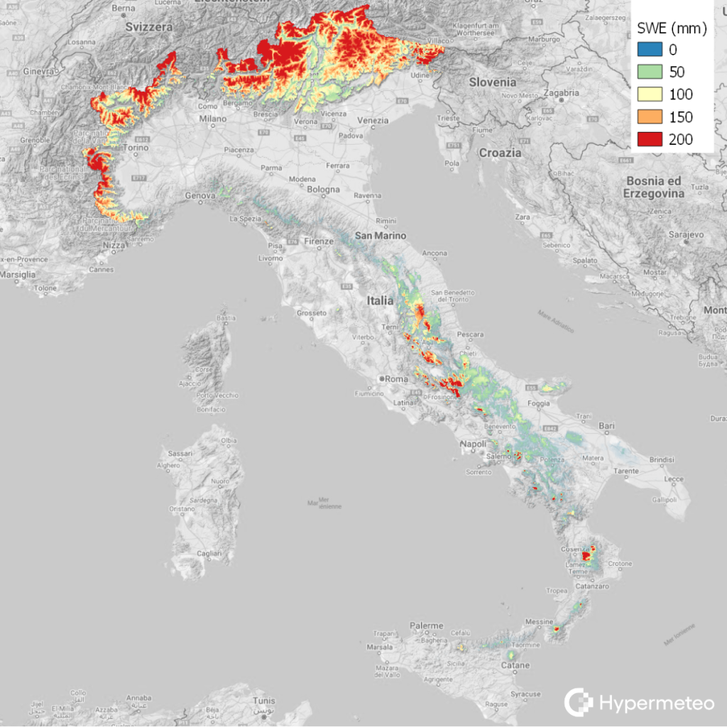
The results obtained in the case study made it possible to replicate the system on a national level (Fig. 2), in order to share the SWE datasets with major national energy and water operators.
CONCLUSIONS AND FUTURE DEVELOPMENTS
This system offers an innovative solution for measuring SWE because it combines several data sources within a flexible and easily upgradable system.
At the same time, new data validation, spatialisation and assimilation procedures will continue to be developed, with the aim of obtaining an increasingly accurate and reliable representation of water resources throughout Italy.
